If you own on the Riviera, you have likely heard about updated fire hazard maps and what they could mean for projects on your property. It can feel overwhelming to sort out what applies to you, especially if you are planning a remodel, a new ADU, or landscape changes. The good news is that with the right steps and early planning, you can move forward confidently and avoid costly surprises. In this guide, you will learn how the maps work, how they affect permits and inspections, and what to do before you design. Let’s dive in.
What the new maps mean
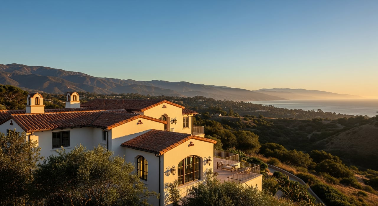
Updated wildfire maps help agencies identify areas where buildings face higher wildfire risk. On the Riviera, these maps guide plan review, wildfire hardening, and defensible space around structures. Your parcel’s designation can affect how you design and how long permits take.
If your home is in a Very High Fire Hazard Severity Zone, you should expect added plan details and more review steps. Even if your parcel sits in a local responsibility area within the City of Santa Barbara, state and local rules still apply when your site falls inside a mapped hazard zone.
Map types that affect the Riviera
Cal Fire Fire Hazard Severity Zones
Cal Fire classifies areas as Very High, High, or Moderate based on wildfire hazard. These state maps are commonly used in permit reviews and can trigger wildfire-hardening standards and defensible-space enforcement. They are the baseline dataset many agencies use.
Responsibility areas: SRA vs. LRA
Jurisdiction matters. State Responsibility Areas are primarily managed by Cal Fire, while Local Responsibility Areas are managed by local agencies. Most Santa Barbara city parcels are local responsibility, but they can still be in a mapped hazard zone that shapes your permit conditions.
Local overlays and fuel-mod zones
The City of Santa Barbara and Santa Barbara County may maintain their own wildfire overlays and fuel-modification zones. These local layers can add requirements on top of state mapping, including fuel modification plans or specific landscape treatments near structures.
How mapping changes permit reviews
Fire department review is standard
If your parcel is mapped in a Very High Fire Hazard Severity Zone or equivalent local overlay, expect a fire department review. Your plans will be routed for conditions related to defensible space, water supply, access, and turnarounds.
Added plan submittals
Projects in mapped zones often require more documents. You may be asked for a fuel modification or vegetation management plan, wildfire-hardening construction details, and sometimes automatic fire sprinklers for new dwellings and some ADUs. The exact triggers depend on local code adoption.
Water supply and fire flow
Higher-risk sites often have increased fire-flow requirements. You may need to verify hydrant locations, flow rates, and duration. In some cases, onsite water storage or hydrant upgrades are required. Having early fire-flow data helps you design efficiently.
Access standards and grading limits
Emergency access rules cover clear width, turning radii, vertical and horizontal clearance, and driveway slope. Narrow hillside streets on the Riviera can create design constraints. Early consultation can reveal if an engineered access solution is needed.
Timelines and coordination
Expect more coordination among planning, building, fire, and outside consultants. This can add weeks or months to the process. Early pre-application meetings help you anticipate conditions and streamline your schedule.
Defensible space on the Riviera
State law requires vegetation management around structures in wildland areas. Many agencies implement a zone-based approach that reduces fuel and breaks direct pathways for fire and embers to reach buildings.
Zone 0 to 5 feet
Keep this immediate perimeter as ignition-resistant as possible. Use non-combustible ground cover and avoid storing firewood, mulch piles, or combustible items next to walls. Simple material choices here can make a big difference.
Zone 5 to 30 feet
Break up fuel continuity near structures. Provide spacing between shrubs and trees, prune ladder fuels, and favor plant choices and layouts that resist ember ignition. Plans typically need to show spacing and species.
Zone 30 to 100 feet
Thin vegetation, remove dead or dying material, and maintain separation that slows fire. Where the property line sits within this radius, you manage defensible space up to that line.
Maintenance and inspections
Defensible space is not a one-time task. Many jurisdictions require ongoing maintenance and may document obligations through recorded agreements or annual inspections. Noncompliance can delay occupancy or trigger enforcement.
ADUs on the Riviera: what changes
Feasibility and siting
Hazard mapping does not usually ban ADUs, but it can reshape feasibility. Steep slopes, narrow access, limited water supply, or tight lots can make meeting fire-flow and defensible space rules difficult. Early site assessments help you decide if a detached ADU, attached ADU, or conversion is the right path.
Typical ADU plan requirements
ADU submittals in mapped zones often include a fuel-modification plan, fire-hardening details for walls, roofs, decks, and windows, and fire-sprinkler plans if required. You will also need to show emergency access, address signage, and water supply data.
Design strategies that help
Simple forms with minimal overhangs, ignition-resistant cladding, ember-resistant vents, and non-combustible roofing reduce friction in review. Landscape designs that clearly show defensible-space zones and compliant plant spacing make approval smoother and reduce revisions.
Cost, insurance, and timing
Cost expectations
You should budget for fire-hardening materials, potential sprinkler systems, and a fuel-modification plan prepared by qualified professionals. Clearing work and ongoing maintenance are additional line items. Some sites require infrastructure upgrades, like hydrant improvements or onsite tanks, which can affect overall cost.
Insurance considerations
Updated hazard designations can influence insurance availability and premiums. It is wise to speak with your insurer early and review state guidance on wildfire risk and coverage options. Proactive hardening and documented defensible space can support your insurance conversations.
Timeline planning
Added reviews and interagency coordination can extend timelines. If access improvements or water-supply upgrades are needed, plan for additional design and construction steps. Early meetings with planning and fire staff can set realistic expectations and reduce delays.
Your pre-permit checklist
Use this step-by-step outline before you spend on design:
- Verify your current map status
- Check your parcel against the most recent state maps and local overlays. Ask the City of Santa Barbara Planning and the Fire Department to confirm your official designation.
- Book early meetings
- Schedule time with the planning counter and fire prevention staff. Ask about local ADU rules, adopted code amendments, and submittal requirements for your site.
- Gather site data
- Update a topographic/site plan, measure distances between structures, map access, and note hydrant locations. Request fire-flow data and take photos of existing vegetation and trees.
- Engage the right experts
- Consider a fire consultant or engineer, a landscape architect or arborist for fuel-mod planning, and a designer versed in wildfire-hardening details and local ordinances.
- Design with fire safety first
- Show defensible-space zones on landscape plans. Specify non-combustible or ignition-resistant construction assemblies and ember-resistant vents. Include sprinkler plans and water-supply calculations if likely required.
- Confirm timeline and insurance
- Ask staff for expected review steps and milestones. Talk to your insurer about how your designation may affect coverage and premiums.
- Document maintenance obligations
- If your approval requires recorded agreements for fuel modification, plan for annual upkeep and include these obligations in your long-term property disclosures.
Practical tips for Riviera owners
- Start with feasibility, not aesthetics. Get access, water, and defensible space right on paper before you refine finishes.
- Keep the home ignition zone clear. Five feet of clean perimeter is a small change with big impact.
- Prioritize a clean roof and ember-resistant vents. Embers are often the primary source of home ignition in wildfires.
- Align your landscape palette with defensible-space standards. Fewer revisions means faster permits.
- Communicate early and often. Coordinating with planning and fire staff saves time.
How to move forward
If you are considering a remodel, addition, or ADU on the Riviera, start by confirming your parcel’s current designation and booking a pre-application meeting. Then assemble your site data and bring in the right experts. Designing for defensible space and wildfire hardening from day one will make your project more resilient and more likely to pass review on the first try.
When you are ready to plan your next move or explore how these rules affect value and timing, reach out for tailored guidance and local introductions to the right consultants. Let’s Connect with Unknown Company to align your real estate goals with a clear, proactive plan.
FAQs
What do new fire hazard maps mean for Riviera permits?
- If your parcel is in a mapped Very High Fire Hazard Severity Zone or local overlay, you will likely face additional plan requirements, fire department review, and wildfire-hardening standards.
How do defensible space rules apply around my home?
- Many agencies apply zone-based treatments up to 100 feet from structures, or to the property line, with stricter rules within 0 to 5 feet to reduce ignition risk.
Will a hazard designation stop me from building an ADU?
- Usually not, but it can add conditions and costs for sprinklers, fire-hardening, access, and water supply. A site-specific assessment is essential to confirm feasibility.
What extra documents might my project need?
- Expect a fuel-modification or vegetation management plan, wildfire-hardening construction details, fire-flow data, and possibly sprinkler plans, depending on local code adoption.
How could these maps affect my homeowners insurance?
- Insurers consider hazard mapping when setting premiums and underwriting. Early outreach to your insurer and documentation of hardening and maintenance can help.
Who can confirm my parcel’s official designation?
- Use state fire hazard maps and request confirmation from the City of Santa Barbara Planning Division and Fire Department, or the County if your parcel is under county jurisdiction.